There are amazing news regarding ATON framework and large/massive 3D datasets.
The first one is that ATON supports multi-resolution through an OGC standard: Cesium 3D Tiles. This was under the hood for the last few years: check out the reference paper explaining more in detail such choice.
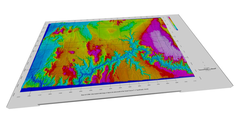
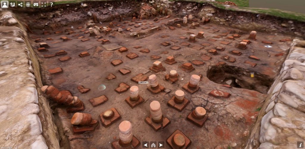
You can now load one or multiple tilesets in a 3D scene, without any restriction in terms of geometry or textures complexity. This is possible thanks to the integration of an open-source library developed under NASA AMMOS project. Here is a sample of multi-resolution dataset in an ATON scene:
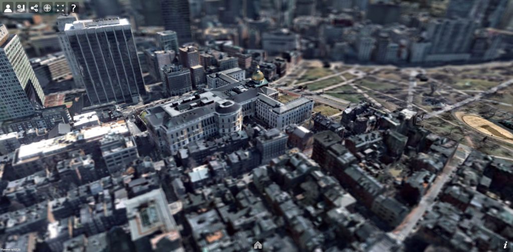
The second is that such standard allows amazing integrations with other pipelines, services and tools. For instance it is possible to load 3D tilesets hosted on Cesium ION, providing a token. Here is a sample of entire Boston city (multi-resolution dataset), streamed from Cesium ION and explored through Hathor (the official ATON front-end) right in your browser, through any device:
This enables ATON 3D scenes to combine geospatial datasets available on the platform with standard glTF models or panoramic content from collections. More in general, integrations are possible with any service that provides datasets in this standard.
ATON offers immersive VR presentation since 2016 (cardboards, 3-DoF and 6-DoF HMDs). The combination of WebXR + multiresolution is fully supported: that means ATON allows to explore large, massive 3D datasets using HMDs (e.g. an Oculus Quest) or cardboards without any installation (soon dedicated paper on this). Furthermore, it is possible to query all geometry, annotate, measure… at runtime! Check out a few examples in this video:
ATON was one of the first open-source solutions in the Cultural Heritage domain to combine WebXR and multi-resolution – back in september 2021. Such investigation and stress tests carried out on NASA AMMOS library also led to a nice cross-contribution between the two open-source projects in 2021.